Where the mountains run into the Pacific and a working port reinvents itself as art - a definitive guide to Taiwan's wild east coast and its harbour-city renaissance in the south.
Taiwan's south and east are the sides most travellers miss, and the ones that stay with those who do not. Shielded from the rest of the island by the central mountains, this is a different country: a marble canyon carved by a turquoise river, cliffs that fall straight into the Pacific, and a great southern port reinventing itself around art and the water.
The almanac
The south & east at a glance
- Coastline
- Pacific frontier
- Headline
- Taroko Gorge
- Harbour renaissance
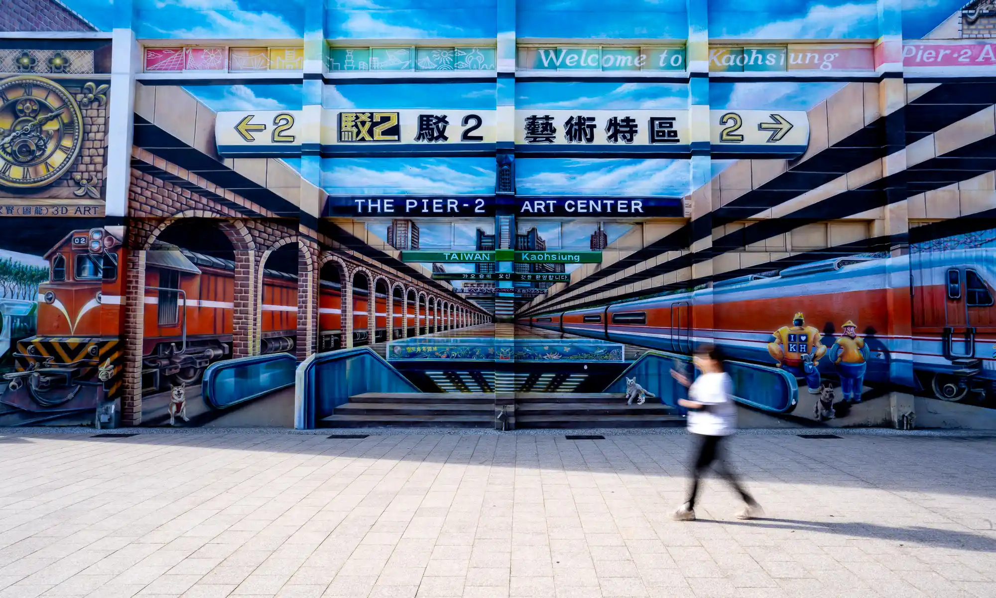
- Kaohsiung Pier-2
- Getting around
- Express train + car
- Signature flavours
- Seafood & mochi
- Best months
- Oct - May
The Pacific frontier
The headline is Taroko Gorge - nineteen kilometres of white marble cut by a river the colour of jade, with a road that threads through tunnels and along ledges beneath sheer cliffs. The trails are short, dramatic and mostly flat; the river did the hard work. North of Hualien, the Suhua Highway clings to the Qingshui Cliffs, among the highest coastal cliffs in the world, where the land drops more than 800 metres into the sea. It is the island at its most elemental - architectural isolation on a geological scale.
- Shakadang Trail - an easy riverside path over impossibly blue water.
- Swallow Grotto - the narrowest, most cinematic stretch of the gorge.
- Eternal Spring Shrine - a temple set against its own waterfall.
- Qingshui Cliffs - the Pacific overlook on the way in or out.
Anatomy of a day
From canyon to harbour
- Sunrise on the Shakadang
- Swallow Grotto
- Qingshui Cliffs
- Pier-2, Kaohsiung
- Harbour sundowner
The harbour renaissance
South, in Kaohsiung, the story flips from nature to reinvention. For a century the city was a working port of cranes and container yards; then, instead of erasing that past, it transformed it. The old dockside warehouses of the Pier-2 Art Center now hold galleries, studios and large-scale public art, linked by a cycling rail-trail; the rippling Kaohsiung Music Center anchors the waterfront; and a short ferry crosses to Cijin Island for seafood and an old lighthouse. It is the most graceful urban reinvention in Taiwan.
On the east coast the mountains run straight into the sea; in the south, a city of cranes learned to make them beautiful.
Where to stay
Silks Place Taroko is the only resort inside the national park; in Kaohsiung, the InterContinental and Silks Club / The Amnis bring harbour-district design and skyline views; and Silks Place Yilan anchors the green northeast on the way down. Compare them below, each with live partner rates for your dates - and the rest of the collection waits at the foot of this page.
Explore the Kaohsiung & Coast Collection